
I should start this blog entry with an explanation. Some of you reading the blog are likely wondering why we went to Hong Kong again to go hiking. Isn’t Hong Kong an exciting, modern city with lots of things to do and experience? It is indeed. Hong Kong is one of my favorite cities in Asia. So why are we out hiking again instead of doing something else? The reason is the weather that we have right now in southern China. There are only about three months of the year here when the daytime highs are in the 60-75 degree Fahrenheit (16-25 degrees Celsius) range, and it is not raining and humid. The rainy season runs from April through October, and daytime highs are consistently above 80 degrees F from April through November. When it is hot and sticky humid and/or raining, that is a good time to go into Hong Kong and go to museums, shopping, etc. Right now the weather is perfect for hiking. So on Sunday we put on our hiking boots and packed our backpacks, and set off to go hike Dragon’s Back trail in Hong Kong.

There were many of these cute trail signs along the Dragon’s Back trail!
Not only does the Dragon’s Back have a great trail name, it was also voted the Best Urban Hiking Trail in Asia by Time (Asia edition) in 2004. I only recently learned about it, but it moved to the top of my to-do-list for Hong Kong because of the many positive online comments about this trail. First, we had to get there. There was no bus to take us across the border this time, as the Foxconn hiking group had gone, as usual, to Wutongshan. So Jeff and I took the subway. First we took the Longhua line from one end, the Qinghu station near Century City, to the other end at the Futian Checkpoint station. This takes about 45 minutes. Then we spent another 20 minutes waiting in lines to cross the border from China into Hong Kong.

Jeff standing next to a cute statue in the Hong Kong Lok Ma Chau subway station
Then we had to change subway lines three times in Hong Kong to get to the Shau Kei Wan subway stop. This took us about another one and a half hours. We were going from one end of the light blue subway line at the top to almost the far right end of the dark blue subway line at the bottom.

Photo showing a map of the Hong Kong subway system
To reach the Dragon’s Back trail we needed to take the number 9 bus from Shau Kei Wan subway station to Collins Road. I love riding on the Hong Kong double-decked buses. You can get a great view from the upper deck as the bus drives up the road! Our bus ride took us very quickly out of the city and into the mountains.
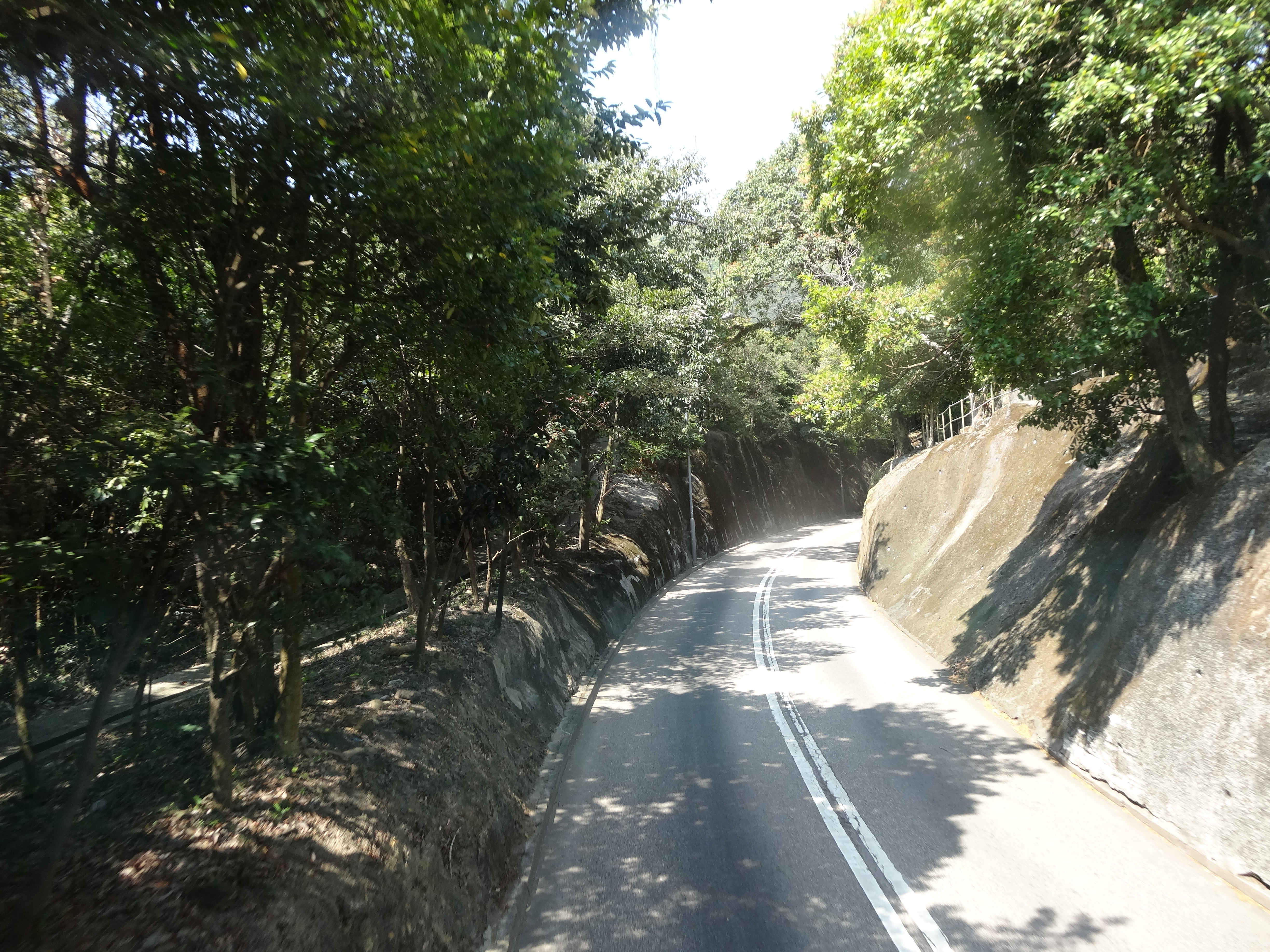
View of the road from the top deck of number 9 bus heading towards the Dragon’s Back trailhead
After about three hours, we finally reached the Dragon’s Back trail head to start our hike.

Jeff is sitting under the sign for the trail where the hike starts
Dragon’s Back is described as an urban hike because it is within close proximity of Hong Kong’s skyscrapers, yet set amid the beauty of the coastal mountains. It meanders across Hong Kong Island’s wild south side, where the ridges of Shek O Country Park offer superb views over Clearwater Bay and several uninhabited islands out in the South China Sea.

View of buildings in Hong Kong from where we started our hike
The Dragon’s Back trail is sometimes characterized as one of the easier Hong Kong hikes. It is, but it’s no stroll either. It did require a decent level of physical effort and hiking boots. That said, it was certainly easier than the Sharp Peak hike that we did a few weeks ago!

Ann hiking along Dragon’s back Trail
The first part of the hike was mostly tree covered hills, with no views. Just when Jeff was starting to get grumpy and complain because there was nothing to take pictures of, we started to climb Shek O Peak. Suddenly, there were great views in all directions!

View from Shek O Peak
From the ridge there are superb views eastwards to Clear Water Bay Peninsula and islands in the eastern sea approaches to Hong Kong.

View of Big Wave Beach from Shek O Peak

View from Shek O Peak
At 284 meters ( 652 feet) high, the top of Shek O Peak is the perfect place to view the Tai Long Wan, the island of Tung Lung, Big Wave Beach, and a resort with a golf course. It was also a great place for Jeff to take his shirt off and work on getting a tan.

Jeff standing next to the Shek O Peak sign
I was clearly trying to do the opposite! I was hot, but well protected from getting a sunburn with my long-sleeved shirt, hat, and sun parasol. I was dressed similar to many of the Asian women that we passed on the trail. Jeff looked like most of the Caucasian hikers that we saw on the trail. And there were many of them. Most of the hikers that we passed were speaking English or French, not Cantonese or Mandarin.

Ann standing next to a sign on the Dragon’s Back trail, with a description of the view in that direction
To the west, there are views of Stanley Peninsula and the South China Sea.

View of Stanley pennisula
The Dragon’s Back trail stretches vertically along the length of D’Aguilar Peninsula. The path undulates between many hill tops, reminiscent of the shape of a dragon’s backbone, thus its name.
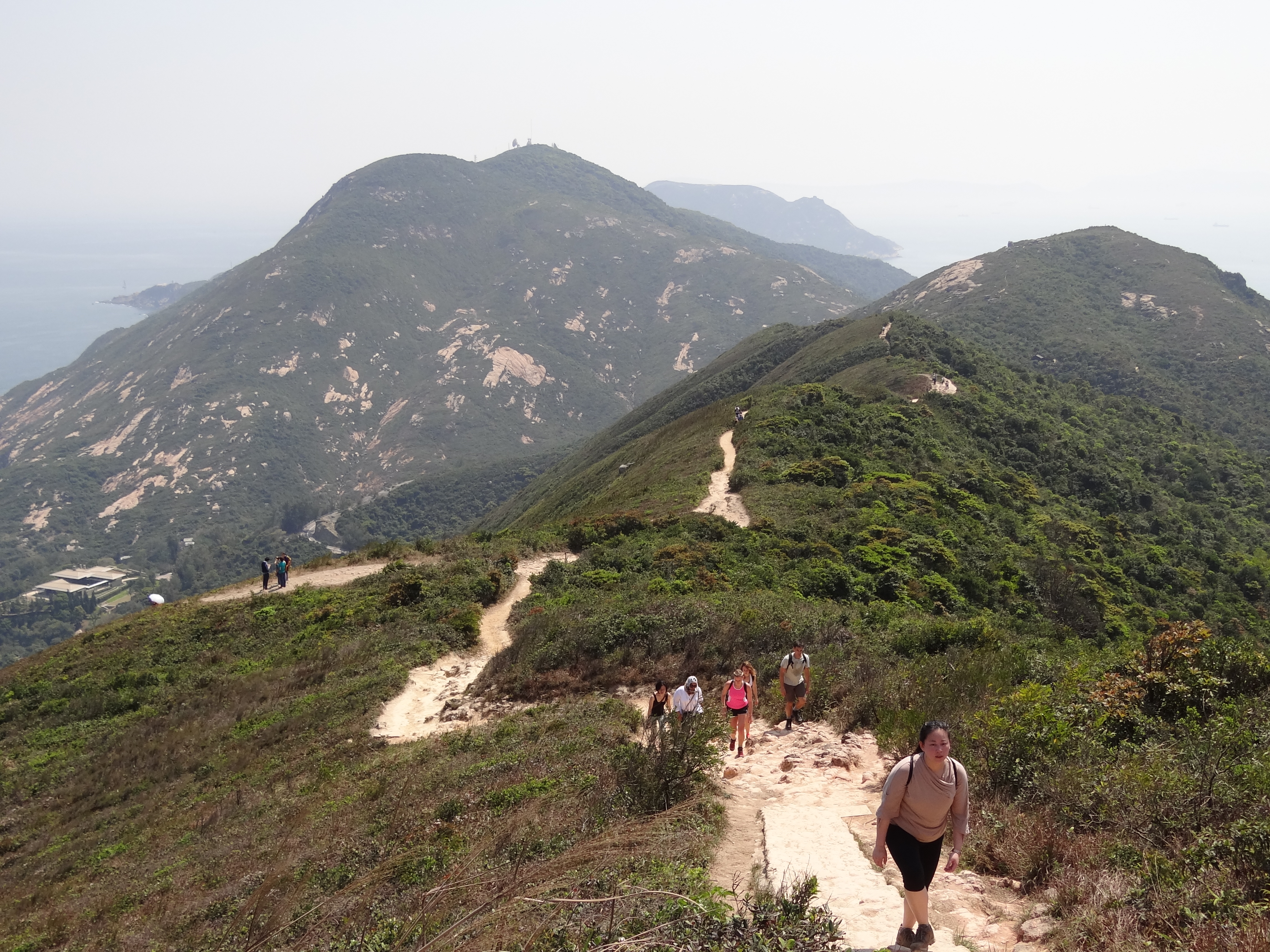
View of the Dragon’s Back trail
We ended our hike at Big Wave Beach. There were a lot of people here, mostly foreigners again, speaking English or French. Kids were playing in the water or digging in the sand, and everyone was eating hamburgers, hot dogs, french fries, and pizza. There were surfers on their boards out in the water, hoping to catch a big wave. But there were no big waves while we were there, so mostly the surfers just sat on their boards It felt very much like a beach back home in the states.

Jeff standing in the sand at Big Wave Beach
I put away my umbrella, rolled up my pants, and played in the water for a short time. I was still likely the most “over-dressed” woman on the beach! But I had fun, and got my pants all wet playing in the small waves. Another thing that made this hike easier than the Sharp Peak hike was that we could catch a ride back on bus number 9 from the beach. So we did not have to hike back to a bus stop, but it still took us another three hours to get back to Longhua from Big Wave Beach.

Ann holding up a piece of nice seaweed she found when she was playing in the waves
Here is the mystery sign of the day. The Chinese character on this sign means student (shue).) It is the middle character in Jeff’s name. Did they really mean No Students on this road? Neither Jeff nor I could explain this one!

No Students sign?
